Ancient Ice Falls

Two Outings to the Yuba-American Divide

Both the South Fork Yuba and North Fork American drainages have their headwaters against 8 to 9 thousand foot peaks of the Sierra Crest, and both flow roughly parallel to each other to the west. They differ, however, in that the North Fork American is two to three times deeper than the Yuba. One outcome of this was that ancient glaciers filling the upper Yuba basins at various times overrode the divide between the two, creating a section of the divide where large ice falls descended into the deeper American, to join its main glacier far below.

Two recent outings to the divide gave an opportunity to better visualize this unusual topography and the spectacle of massive ice field and long-tongued glaciers that rode down from the summits as recently as 15 thousand years ago.

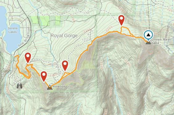
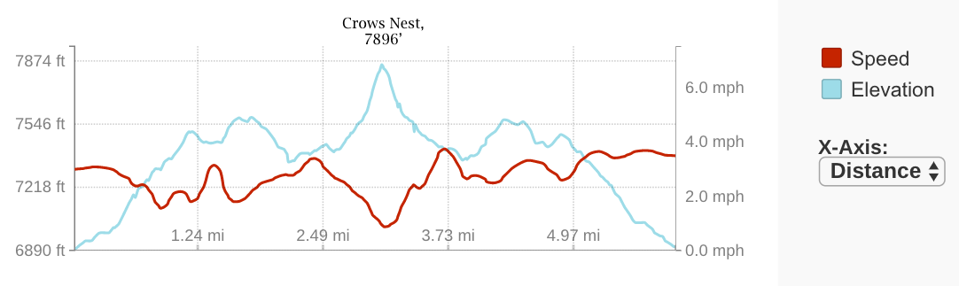
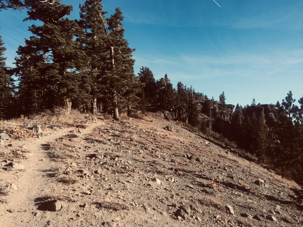
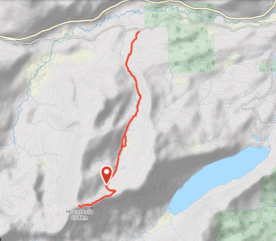
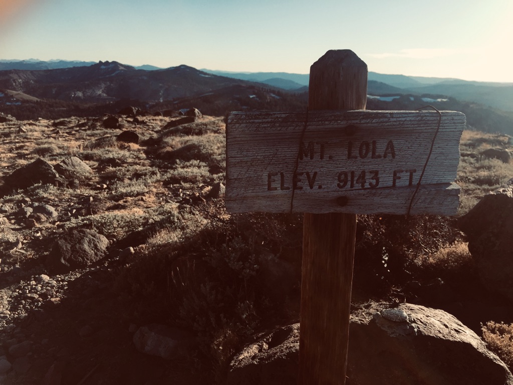
Razorback Ridge to Crows Nest — 17 Nov. 2019, 6 miles return, elevation gain +1,006

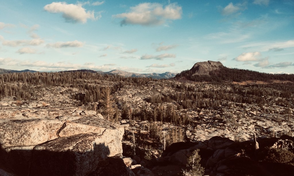
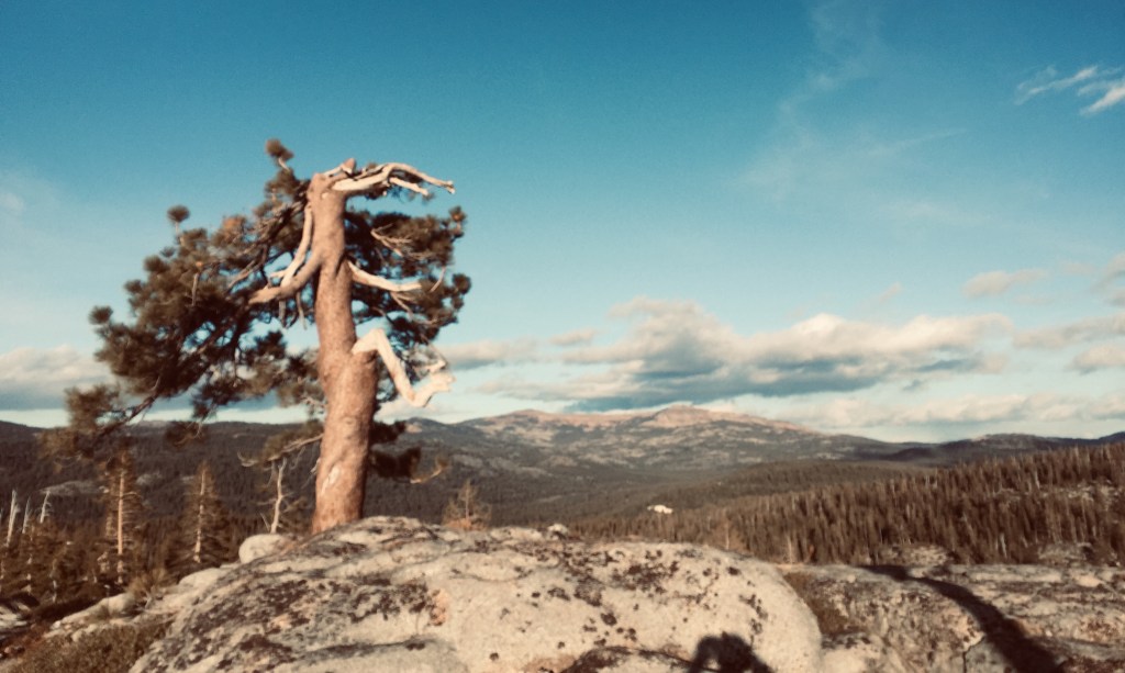
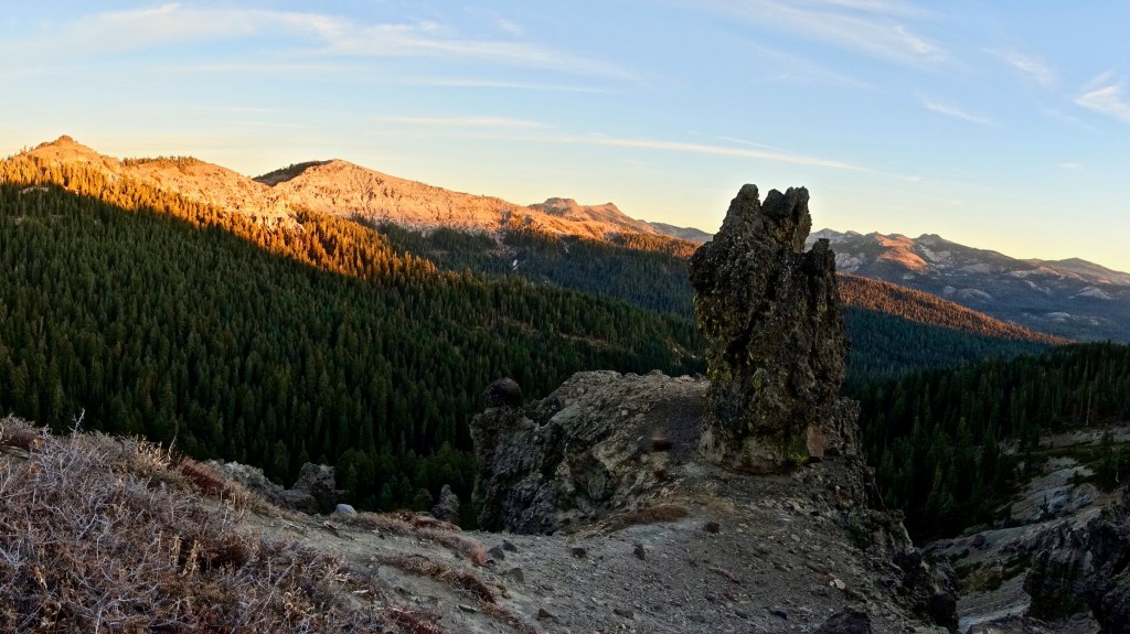
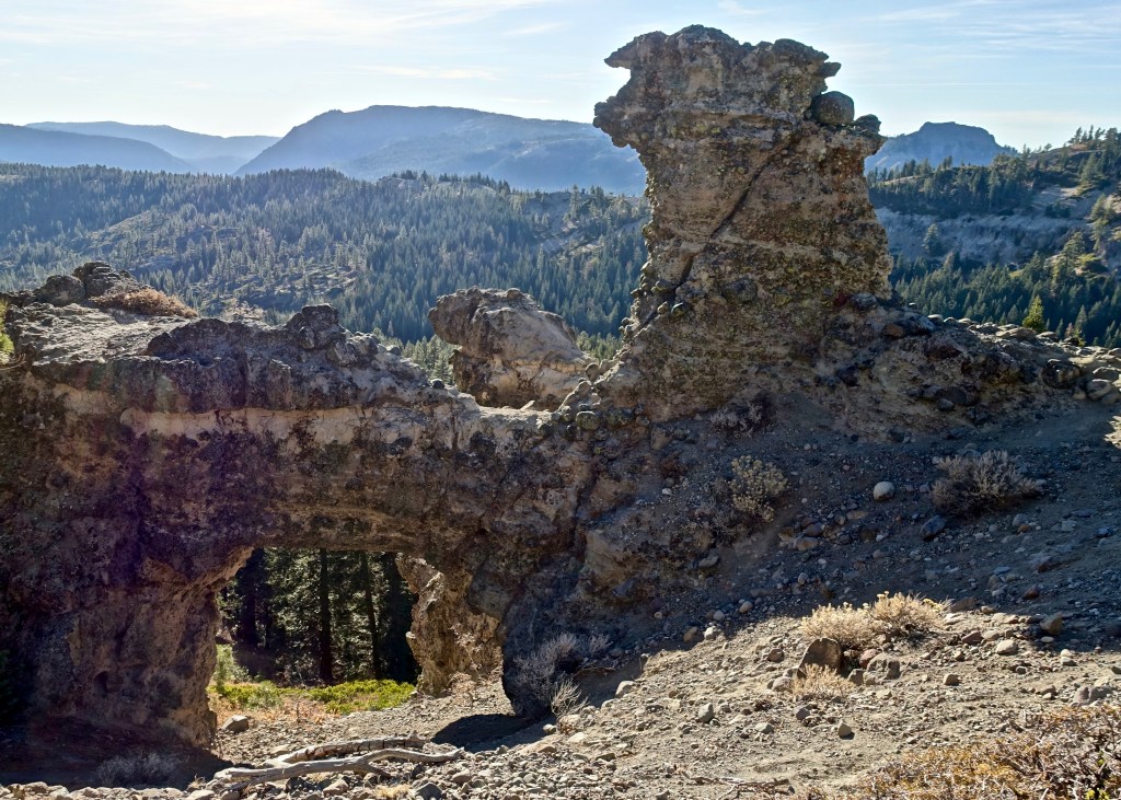
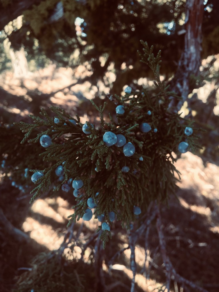
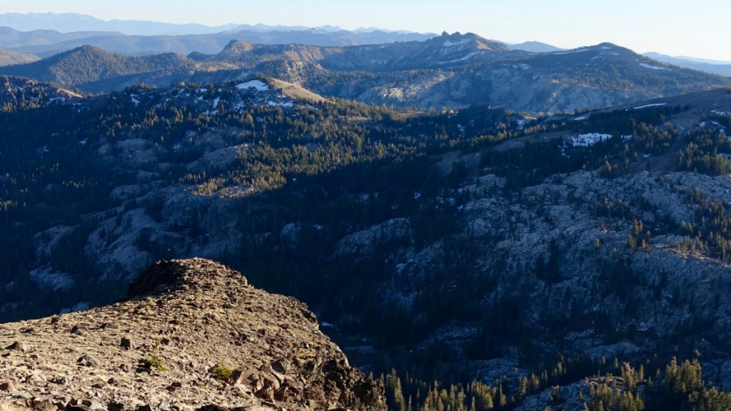
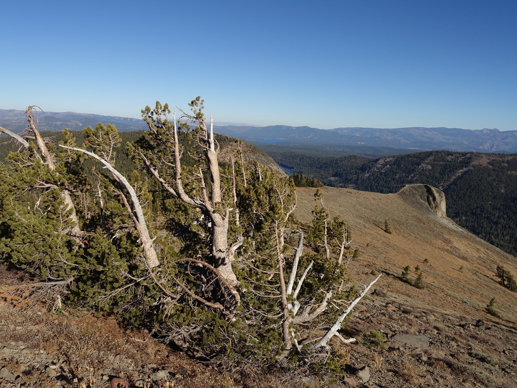
The ridge has outstanding views of the headwaters of both the Yuba and America drainages. Andesite, Castle, Donner, Judah and Mt. Lincoln dominate the Yuba, while Anderson, Tinker’s Knob, Granite Chief, Needle and Lyons Peak enclose the American. The ridge itself is composed of recent volcanic layers – ash, welded pyroclastic flows, and the andesite tower of Crow’s Nest. The two faces of the ridge, however, present strongly contrasting features. On the north, where the main ice field of the upper Yuba once covered the shoulders of the ridge to its crown, forest of White and Red Fir, Western White Pine, Sierra Juniper and Mountain Hemlock crowd the slope. Generally just below the ridge top, but sometimes at the top or even down the lee side a few meters are numerous glacial erratics – granodiorite – in striking contrast to the volcanic strata of the ridge itself. Jeffrey pines, in particular stand in exposed locales, often presenting broken tops and wind-sculpted limbs. The south or lee side of the ridge is steeper, mostly barren and deeply eroded into cliffs, ravines, and an irregular series of pillars and other asymmetrical forms carved out of the welded pyroclastic conglomerates. There is even one natural arch. The ascent to Crows Nest is steep only near the end, and the climb up the broken tower itself an easy class 2 scramble.

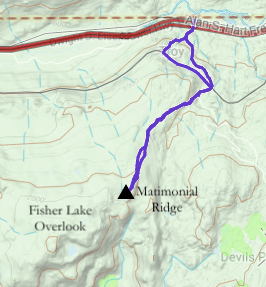
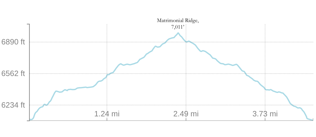
Matrimonial Ridge — 26 Nov. 2019, 4 miles return, elevation gain +971

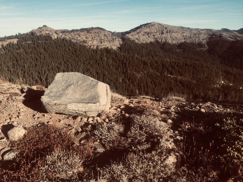
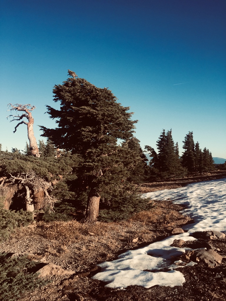
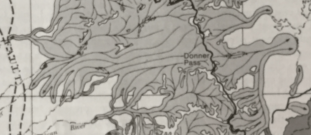
The climb from Hwy 80 and the South Fork of the Yuba River to Matrimonial Ridge is a standard ski, snowshoe or snowmobile route in winter. Without snow it is actually more difficult, with the last roadless, trail-less part of the route dense with forest and crowded with huckleberry oak and manzanita growing between granite ridges and benches. Reaching the first summit of the exposed ridge-top leading to Fisher Lake Overlook, a place informally called ‘Matrimonial Ridge,’ There is polished granite and two solitary Jeffrey Pines. Although overridden by glaciers here at some point, the ridge stands prominently above the landscape so that all of the Granite Creek drainage, once a great ice fall down to the American, can be seen, as well as many of the same peaks of the Yuba and American seen from Razorback Ridge. Nearby is Devil’s Peak, a cockscomb-like ridge composed of columnar andesite that stood above the glaciers and acted as a topological divide between two bodies of ice descending in parallel into the American. Also striking is the uneven terrain on both sides of the divide here. Numerous ridges, hummocks, and benches, all fashioned by the glaciers out of the granite bedrock stretch out across the landscape. It makes for complicated terrain with many small lakes. most of them at the Yuba-American divide, or further down into the American River drainage. Some of these lakes, such as the three Loch Leven Lakes, have trails to them and are popular destinations. Others, such as Nancy or Fisher Lake are cross-country trips and are infrequently visited.

Glacial Maximum showing west and east flowing glaciers descending from ice fields along the Sierra Nevada Crest. Note the south-turning glacial tongues descending from Donner Pass area to join the North Fork American Glacier. From J. P. Schaffer’s, The Tahoe Sierra, 1999.
Cross section showing the high glacial basin of the South Fork of the Yuba and the much deeper incision of the North Fork of the American. Both images adapted from Gaiagps.

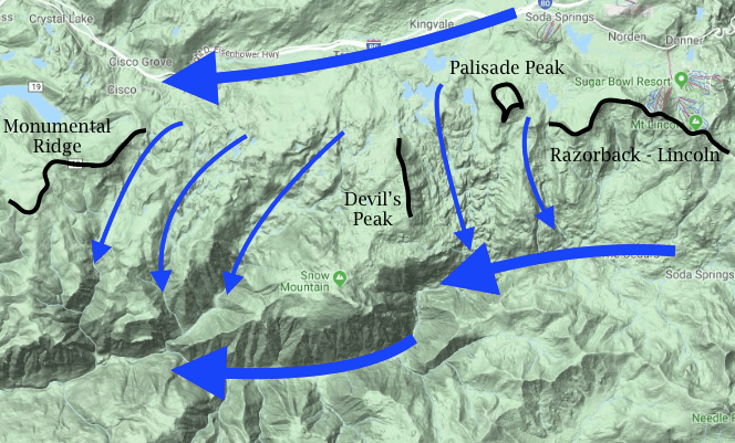
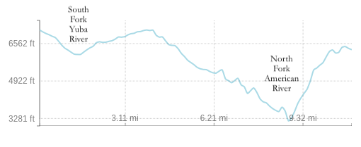
In its large scale, the asymmetry of the two canyons — Yuba and American — is striking. Why was the American cut so much deeper? Did the overriding glaciers from the Yuba icefield contribute to this depth, or was there a pre-glacial reason? The position of the glacial passes between the Yuba and American is also interesting. From the Sierra Crest to Razorback Ridge there are no breaches in the divide between the two. Then, between Razorback Ridge and Monumental Ridge, much to the west, five major drainages cut down into the American, each one being a breach in the divide, with most of the divide in this section continuously overridden at the glacial maximum. Only two prominent features stood above this icy inundation — Palisade Peak just west of Razorback Ridge, and Devil’s Peak, which extends out south to the high wide ridge of Snow Mountain, also glacier-free.

Standing atop Matrimonial or Razorback Ridge one sees clearly how these two watersheds – the Yuba and American — are intimately linked topographically, yet dramatically different.

Summit Bread

I wandered lonely
trackless
Having left trail
out of forest
broken and decayed underfoot
following hummocks
of granite spine
into cloud-driven sky

On cold summits
With their solitary jeffrey pines
earth lay down
Its argument
Wide, fulsome, all things
woven into the other
the very vastness of vision
A kind of bread
To eat
So that I need not even
Spill blood
To be brother
With the cliff-edge rocks
We who ride together
this wheeling, spherical
earth turtle
into starlight.


25 November 2019
Fisher Overlook Ridge, 7011'
A day before first winter storm


Glacier Ghosts

They lay heavy
over the earth here once
hundreds of feet thick
Riding the eroded volcanic ridge
Itself the ruin of millions year older
Pyroclastic flows
Down from mountain crest
Leaving
Rounded granite boulders
Larger than tables
Carried from
Donner Peak, miles away
Crumbs
To this ancient white monster
Scattered just below
Ridge's edge

Now it is pillar saint
Jeffrey Pine
flat-topped, limbs sculpted
Into grand upward gestures
Recumbent manzanita and huckleberry oak
Massive old Junipers
Berries ready for harvest
Volcanic gargoyle pillars
Carved into ridge's lee side
Conglomerate torsos, arches, fists
...And I, who am
Dancer on this parapet line
Between watersheds
Yuba - American
Their long-lost ice streams
flowing still
as ghosts filling the open spaces
of wide canyon.


17 November 2019
Razorback Ridge-Crows Nest, 7,500-7,900'
High cirrus and blue sky


Upholder of the Way

Hairy Woodpecker, Dryobates villosus
Mdf CC BY-SA 3.0
(http://creativecommons.org/licenses/by-sa/3.0/)
 Long moments
Watching the hairy woodpecker
Making her way
Up the burnt and blackened ponderosa
From recent wildfire
Bark flicking off
Probing, insistent pecking
While the figures and shadows
Of turkey vultures
Cut across sky
On this promontory
Ridge with afternoon updraft
And views 
out over
The great valley
Even to the Coast Ranges.


Upholder of the way
Keeper
Of the practice
Grooved deep in instinct
Buddha
To my bodhisattva
I vow
To listen
To your braaap-bra-da-dap
As intently as to
A temple bell
Calling
To prayer.


15 November 2019
Kentucky Ridge, 2300’
Moon past full, waiting for rain

Seeing Place

 Eastside
Up the Little Truckee
yellowing
meadows, rusty willows
Cold Stream Creek
iced edges
October’s early snow
crescents against volcanic headwalls

Mt. Lola
prominence highpoint 
November’s
low-angled sun
Sierra crest lifts choppy waves
South, white-frothed
All the way to Round Top
Rose, in Nevada
Arches her double back, east
Lassen, leaning forward
from far north
close enough to taste
with vision
West wall of coast range
holding the skirt 
of Central Valley, Sutter
Buttes poking up
through the haze and fog.

All etched
crystalline sky, dry autumn
body laid out on its own
operating table
sagebrush summit
white bark and mountain hemlock
ourselves


10 November 2019
Mt. Lola, 9,143’
Cold Stream Canyon to Mt. Lola — 10 Nov. 2019, 1.5 hours to trailhead from Nevada City:
Turn off from paved road, to the right, crossing the Little Truckee river and taking the first right onto the old Henness Pass Road, dirt, about 4 miles total to the signed trailhead,
9 miles return, about 2.5 hours ascent, elevation gain +2,500′

A party of seven, leaving from the trailhead a bit after 11 am and returning in the dark at 6 pm. Spent 2 hours on the wide, open summit, taking in the view, the warm sun, sky clear, almost windless, exceptional clarity.

Upon close examination identified four conifer species on the summit in isolated stands — Jeffrey Pine (Pinus jeffreyi) on the warmer west and south slopes, Mtn. Hemlock down from the summit snowfields, Western White Pine (P. monticola) on the approach ridge, and one verified specimen of White-bark Pine (P. albicaulis), as indicated by the dense groups of 5-bunch needles, bark paler and less grooved than P. monitcola, and broken-apart cones at the base of the tree.

Along this section of the Northern Sierra, Pinus albicaulis is rare, occurring only on a few summits and ridges in the stretch between the higher Desolation Wilderness and the higher and more northerly Lassen National Park – Anderson Peak, Castle Peak and Basin Peak being the only locales presently identified. That the species can persist in very small numbers at wide intervals along the crest is intriguing. Clark’s Nutcracker, seen perched on a P. monticola during the descent, is a main dispersal agent. Further field work is needed to confirm rarity and distribution. This is hampered by the similarities between P. albicaulis and P. monticola, which is widespread on the approaches to the summits and adopts a ‘krummholz’ form very similar to P. albicaulis. Presence of cones is currently my only way to verify species definitively. For comparison, consider the cone of a Pinus monticola, found less than 10 meters away from the single, verified Pinus albicaulis:

Mt. Lola itself is a center post of this tent landscape that is the Northern Sierra. Highest peak in our Yuba Watershed and in Nevada County, it is also has a prominence of over 2,000 feet, the nearest such peaks being Mt. Babbitt to the north and Pyramid Peak in Desolation to the south. With its flat summit and long, high ridges it stands as a viewing platform for the Northern Sierra. One gazes almost to the Pacific, with the Coast Ranges forming the western boundary and the vast Central Valley spread out below. To the east, there is Mt. Rose and first ranges of the Great Basin, with the high, dry Sierra and Martis valleys in between. To the north, the first great volcano of the Cascades, Mt. Lassen, looms, with the last crests of the Sierra trailing off. To the south, most dramatically, the Sierra Crest builds with peak upon peak, gradually rising up to sculpted Pyramid Peak, Round Top, beyond Carson Pass, and wide-saddled Freel Peak, lording over Lake Tahoe. This, then, is home country. On a crystalline day one feels the closeness and connectedness of the landscape, each feature flowing into the other, all equally part of my walking, traveling, visioning, dwelling body. Storms feed the summits here with water coming to my house, to local streams that wind their way through the foothills, with farms, gardens and orchards that bring food to my table. To the east, dry lands connect me to the wet, Pacific slopes precisely because of their dryness. It is the necessary balance, the yin-yang of earth, wet, forested range bound to dry, rain-shadow hinterlands. In similar ways, I am connected north to south by the cresting ranges themselves. My foothills and their high peaks stand only in solidarity with the whole range of peaks. They cannot exist alone. All of them, they participate in that same rise and stretch of continent, age-old, with its volcanics, its fault blocks. On Mt. Lola this day, I stand atop an axis mundi, a shaman’s pole from which heaven is not far and the rootedness of earth drives itself firm.

In some faint way, we all feel it, journeying up here. Mountain bikers who passed us on the trail linger on the summit with us before making their extreme, quick descent to cars below. Other hikers join us, finding their own solitary vistas. We pry open the metal summit log box to leave a note of our visit here. The mountains stare at us with their own open mouths, each their own tent poles holding up the whole-earth fabric as much air and stars as ridge and valley. Pleasure hike fuses in this modern age with the echoes of pilgrimage – for me, simply to the center of ourselves, to the home altar we speak from and breathe from that is everywhere.